 http://personalpages.manchester.ac.uk/staff/m.dodge/cybergeography/atlas/landweber_version_16.gif
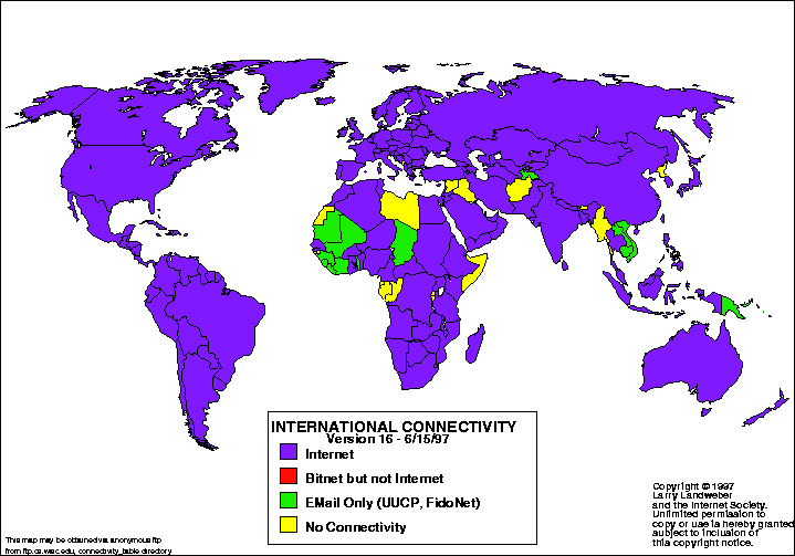
This statistical map is a map showing the international connectivity for June 1997. Through the use of statistical data and color coding, the map shows the areas with internet, email only, etc.
No comments:
Post a Comment