 http://proceedings.esri.com/library/userconf/proc99/proceed/papers/pap171/p1712.jpg
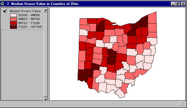
Bivariate choropleth maps uses color to solve a problem using longitude, latitude and 2 statistical variables. This map shows the median house value in Ohio counties.
No comments:
Post a Comment